Explore by Budget · Puerto Rico guides

Southwest Puerto Rico & Cabo Rojo: Beaches, Food & Coastal Scenery

Give the southwest its own chapter. Start with one beach, understand the coastal communities around it, and make space for food or the lighthouse peninsula rather than trying to do everything in one outing.

Find your bearings

Understand the geography

You are here: Southwest Puerto Rico · Cabo Rojo & Lajas

Explore the map, then plan the stop

Choose a place on the map or from the cards below. Colors and icons distinguish beaches, food and other stops. This is an orientation map, not a driving route.

N ↑Cabo Rojo town · Town / practical stop · AreaCabo RojoBoquerón · Food stop / area · Coastal areaBoquerónPlaya Buyé · Beach · Specific destinationPlaya BuyéEl Combate · Beach · Specific destinationEl CombatePlaya Sucia · Beach · Specific destinationPlaya SuciaLos Morrillos Lighthouse & peninsula · Scenic stop · Specific destinationLos Morrillos LighthouseCabo Rojo Salt Flats · Nature · AreaCabo Rojo Salt FlatsLa Parguera · Food stop / area · Coastal areaLa PargueraJoyuda · Food stop / area · Coastal areaJoyudaEl Gato Negro · Food stop / area · Specific destinationEl Gato NegroEl Gatito · Food stop / area · Specific destinationEl GatitoN ↑Cabo Rojo town · Town / practical stop · AreaBoquerón · Food stop / area · Coastal areaPlaya Buyé · Beach · Specific destinationEl Combate · Beach · Specific destinationPlaya Sucia · Beach · Specific destinationLos Morrillos Lighthouse & peninsula · Scenic stop · Specific destinationCabo Rojo Salt Flats · Nature · AreaLa Parguera · Food stop / area · Coastal areaJoyuda · Food stop / area · Coastal areaEl Gato Negro · Food stop / area · Specific destinationEl Gatito · Food stop / area · Specific destination
Town / practical stopFood stop / areaBeachScenic stopNature

Lines connect labels to places, not routes. For arrival details and current access, use the guide entry. Location data © OpenStreetMap contributors (opens in a new tab).

Plan the experience

Cabo Rojo is a region to explore, not one beach

The town is inland. Buyé, Boquerón, El Combate and the southern peninsula are distinct places; where you stay changes the shape of each day.

Buyé sits on the coast north of Boquerón. El Combate is farther south on the western shore. Playa Sucia and the Los Morrillos peninsula form a different southern landscape near the salt-flat area. Use the map to group stops; it is an orientation tool, not a driving route or an assertion that roads are open.

La Parguera is east of this cluster, in Lajas. It can add food or a separate boat outing, but it should not become an automatic extra at the end of every Cabo Rojo day. Compare a regional stay with a return journey from San Juan before committing to several stops.

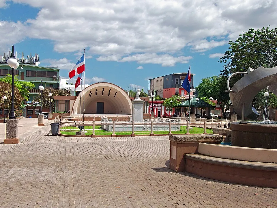
Plaza Pública Dr. Betances · Cabo Rojo — Plaza Pública Dr. Betances

Plaza Pública Dr. Betances · Cabo Rojo

Photo courtesy of Jerjes Medina Albino (opens in a new tab) · CC BY-SA 3.0 (opens in a new tab) · Resized/converted; display may crop.

town · Area

Cabo Rojo town

The town is inland from the beach communities. Use it to understand the regional layout; staying in Cabo Rojo does not necessarily mean staying beside the sand.

Regional orientationChoosing a base

The marker is an orientation anchor for this area, not its only destination. Choose your entrance or arrival point before traveling.

Plan this experience

Check access separately from transport, parking, food and activities. No total price is quoted.

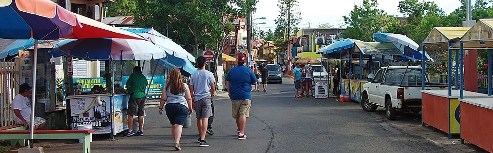
Boquerón town streets · Cabo Rojo — Turistas en Boquerón

Boquerón town streets · Cabo Rojo

Photo courtesy of Jerjes Medina Albino (opens in a new tab) · CC BY-SA 3.0 (opens in a new tab) · Resized/converted; display may crop.

town · Coastal area

Boquerón

A coastal village and food area in Cabo Rojo. Distinguish time in the village from a visit to the balneario and its current facilities.

Food nearbyCoastal base

The marker is an orientation anchor for this area, not its only destination. Choose your entrance or arrival point before traveling.

Plan this experience

Check access separately from transport, parking, food and activities. No total price is quoted.

The EBB approach

Plan by budget, then confirm the total

These are planning targets in USD, not verified package prices. Access, the journey, food and paid experiences belong in separate parts of the budget.

Free / Under $100 / Under $500 / Under $1,000 / $1,000+

Plan the experience

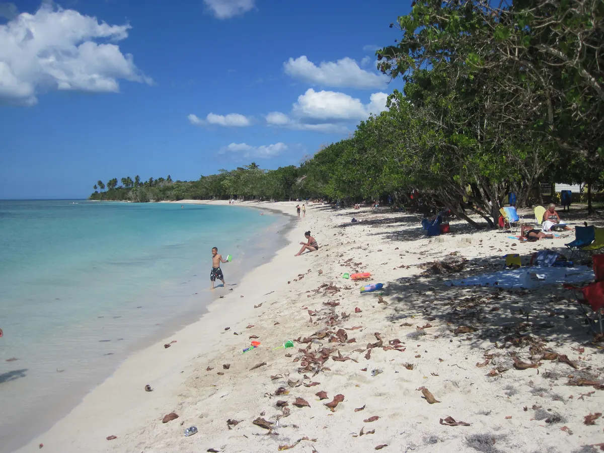
Buyé and El Combate: two firsthand beach picks

These are the two selected firsthand southwest beaches. Choose the one that fits your base and the kind of day you want.

For a Buyé day, give the beach room in the itinerary instead of treating it as a photograph between transfers. Boquerón can be a separate village-and-food chapter if it fits. For El Combate, plan around the southern coast rather than automatically returning north between each activity.

Both picks are based on personal visits, not current reports on parking, shade, restrooms or water conditions. Confirm the actual access point and essential facilities. A beach day can still include transport, food and equipment costs even when the shoreline itself is the main attraction.

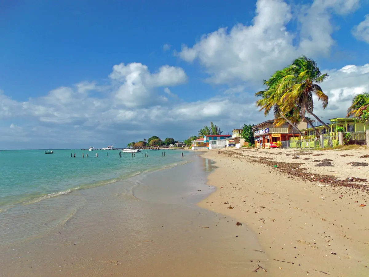
El Combate beach with palms and waterfront buildings

El Combate · Cabo Rojo

Photo courtesy of Jerjes Medina Albino (opens in a new tab) · CC BY-SA 3.0 (opens in a new tab) · Resized/converted; display may crop.

Editor’s Pick

beach · Specific destination

El Combate

Another firsthand beach pick in Cabo Rojo. Compare it with Buyé when deciding how much of your trip to spend in the southwest.

Southwest baseCoastal discovery
Plan this experience

Beach admission, parking, transport and rentals are separate questions. Check each before budgeting.

Plan the experience

Playa Sucia, Los Morrillos and the Salt Flats

This chapter is about the landscape as much as the beach. Playa Sucia is a researched recommendation, not an Editor’s Pick.

Keep three decisions separate: reaching Playa Sucia, approaching the lighthouse peninsula, and visiting the Salt Flats unit. An open refuge facility does not confirm a usable road to the lighthouse or access to its interior. Ask the relevant authority about the specific part of the outing you intend to do.

At our October 1, 2026 review, the Fish & Wildlife Service posted a temporary closure of the main road to refuge headquarters and directs visitors to the Salt Flats unit. Check its live notice before departure; this is not a blanket closure of every Cabo Rojo attraction. Avoid relying on old hours or copying a road approach from a past visit.

Bird habitat and coastal viewpoints are reasons to slow down. Respect posted boundaries and protected areas. Do not approach a cliff edge or enter the water simply to reproduce a photograph; conditions should determine the visit.

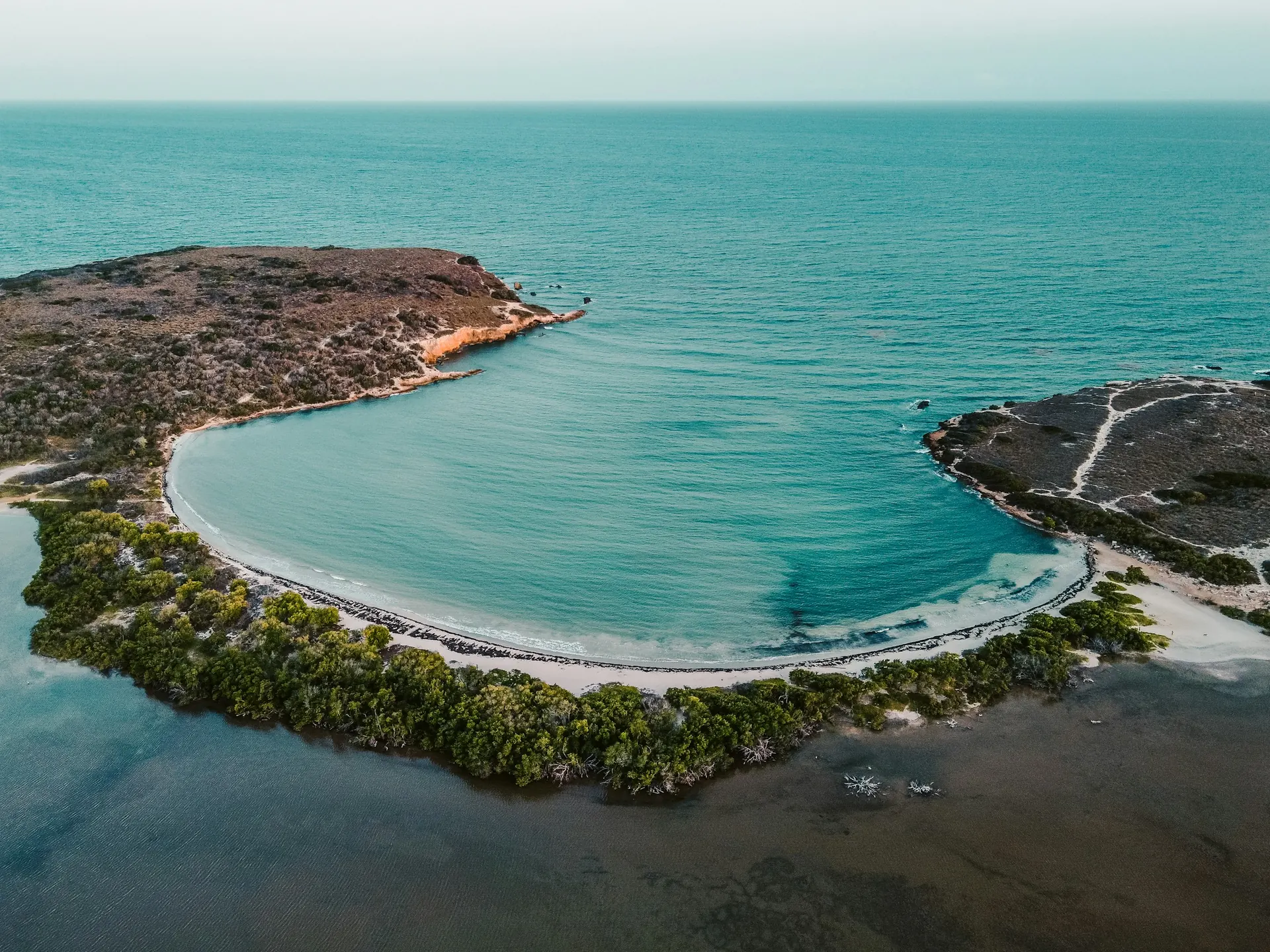
beach · Specific destination

Playa Sucia

A researched recommendation for its crescent shoreline near Los Morrillos Lighthouse. Check current access before making it the centerpiece of a Cabo Rojo day.

Coastal scenerySouthwest discovery
Plan this experience

Beach admission, parking, transport and rentals are separate questions. Check each before budgeting.

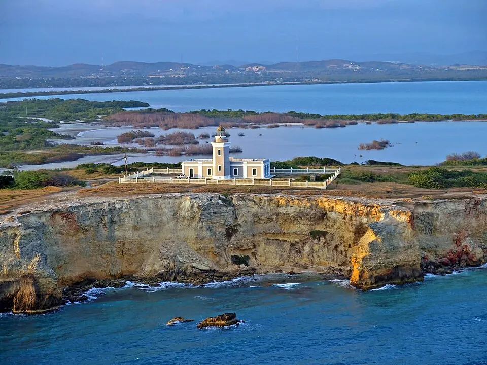
Los Morrillos Lighthouse · Cabo Rojo — Faro de Los Morrillos

Los Morrillos Lighthouse · Cabo Rojo

Photo courtesy of Jerjes Medina Albino (opens in a new tab) · CC BY-SA 3.0 (opens in a new tab) · Resized/converted; display may crop.

history · Specific destination

Los Morrillos Lighthouse & peninsula

The lighthouse peninsula gives the southwest outing a coastal-landscape chapter beyond the beach. Interior entry, walking access and the road approach need separate checks.

Coastal sceneryHistory

Approximate location; confirm the entrance and current access before traveling.

Plan this experience

Check access separately from transport, parking, food and activities. No total price is quoted.

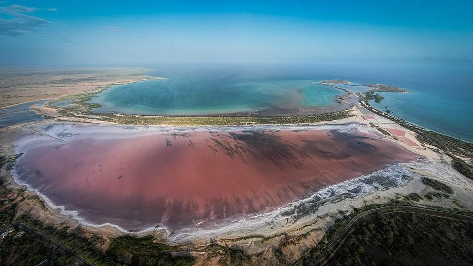
nature · Area

Cabo Rojo Salt Flats

A refuge landscape of saline lagoons and bird habitat. The Salt Flats unit and refuge headquarters are different access points; check the official notice before setting out.

NatureCoastal landscape

The marker is an orientation anchor for this area, not its only destination. Choose your entrance or arrival point before traveling.

Plan this experience

Check access separately from transport, parking, food and activities. No total price is quoted.

Plan the experience

Joyuda, Boquerón and La Parguera: give food its own stop

A meal gives the outing a useful pause. Joyuda, Boquerón and La Parguera are distinct coastal food areas. Choose a meal that fits the coast you are exploring.

Joyuda is a coastal community within Cabo Rojo, north of the Buyé and Boquerón beach cluster. El Gato Negro and El Gatito are two food stops personally visited for this guide. They are separate neighboring restaurants, not interchangeable names and not automatically Editor’s Picks. Choose a meal deliberately rather than adding a northward detour to every southern beach day.

In Boquerón, separate time in the village from using the balneario. Choose a restaurant or food stop that is actually operating when you arrive, review its current menu and allow time to eat. Confirm service before making a special trip.

For La Parguera, decide whether the goal is food, a waterfront visit or a booked boat activity. A boat outing needs its own operator, departure point, weather plan and return arrangements. Do not assume marine activities, equipment or a night outing are included in a general visit.
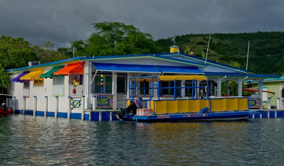
Joyuda waterfront · Cabo Rojo — Dining in Joyuda, Cabo Rojo, Puerto Rico

Joyuda waterfront · Cabo Rojo

Photo courtesy of Cryo Mariena (opens in a new tab) · CC BY-SA 2.0 (opens in a new tab) · Resized/converted; display may crop.

food · Coastal area

Joyuda

A coastal community and food area within Cabo Rojo, north of Buyé and Boquerón. Pair a meal here with the northern coast of your regional plan; Joyuda is not a separate municipality.

Coastal food areaPlanning a meal

The marker is an orientation anchor for this area, not its only destination. Choose your entrance or arrival point before traveling.

Plan this experience

Restaurant meals and transport are separate costs; compare the current menu and your starting point.

El Gato Negro · JoyudaPhotography to come

food · Specific destination

El Gato Negro

El Gato Negro is a firsthand food stop in Joyuda, personally visited for this guide. Consider it when a meal along Cabo Rojo’s northern coastal food area fits the outing. Confirm current service directly before a special trip.

Firsthand food stopJoyuda coastal outing
Plan this experience

A restaurant meal is a paid expense. No current menu prices or dollar tier are quoted.

El Gatito · JoyudaPhotography to come

food · Specific destination

El Gatito

El Gatito is a firsthand food stop in Joyuda, personally visited for this guide. Consider it when a meal along Cabo Rojo’s northern coastal food area fits the outing. Confirm current service directly before a special trip.

Firsthand food stopJoyuda coastal outing
Plan this experience

A restaurant meal is a paid expense. No current menu prices or dollar tier are quoted.

Plan the experience

Choose the base around the coast you want

Compare actual properties and dates. A municipal name on a listing tells you less than its location relative to your planned outings.

Beach-led stay

Map the accommodation against Buyé, Boquerón or El Combate before booking. Check parking, arrival instructions and the journey to food rather than assuming every Cabo Rojo stay is beachfront.

One focused day

Choose a beach and a food stop. Add a scenic chapter only after checking access and how much time remains. Keep the return manageable rather than squeezing in every mapped point.

More than one day

Separate a beach day from the southern peninsula and refuge landscape. La Parguera can become another deliberate chapter if the trip has enough time.

Plan the experience

Budget for the journey and the changes of plan

Transport, parking, meals and booked outings belong in the total. No numerical price or guaranteed free facility is inferred here.

A simple day can revolve around one shoreline and a meal; a bigger spend can support a regional stay or a well-chosen guided outing. Ask what a quote includes and confirm cancellation terms before treating an activity as the centerpiece.

Before departure, confirm the exact access point, road and facility status, and the beach forecast. Keep a town or food alternative if conditions rule out the coastline. Reliable access information is more useful than an ambitious list of stops.

Questions before you go

Can I combine all of these places in one day?

The map shows relationships, not a promise that every stop fits. Choose one beach and one complementary chapter, then check access and the return. More time allows separate beach, peninsula and La Parguera outings.

Is Playa Sucia also called La Playuela?

Yes. Playa Sucia is the primary name used here for the crescent beach near the Los Morrillos peninsula. It is a researched recommendation rather than a personally visited Editor’s Pick.

Does the refuge notice mean the whole peninsula is closed?

No such conclusion should be drawn. The reviewed notice addresses the headquarters road and identifies the Salt Flats unit as an alternative. Confirm the specific road, facility or attraction you intend to visit with the responsible authority.