Explore by Budget · Puerto Rico guides

East Coast Puerto Rico: Luquillo, El Yunque, Fajardo & Island Connections

Choose between a shoreline day, a forest visit and a boat outing before combining them. Luquillo, Fajardo and Ceiba connect these experiences geographically, but each asks for its own practical plan.

Find your bearings
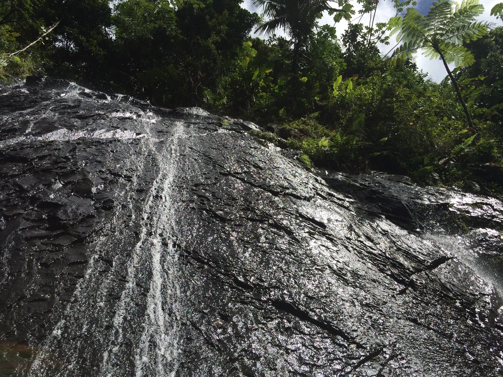
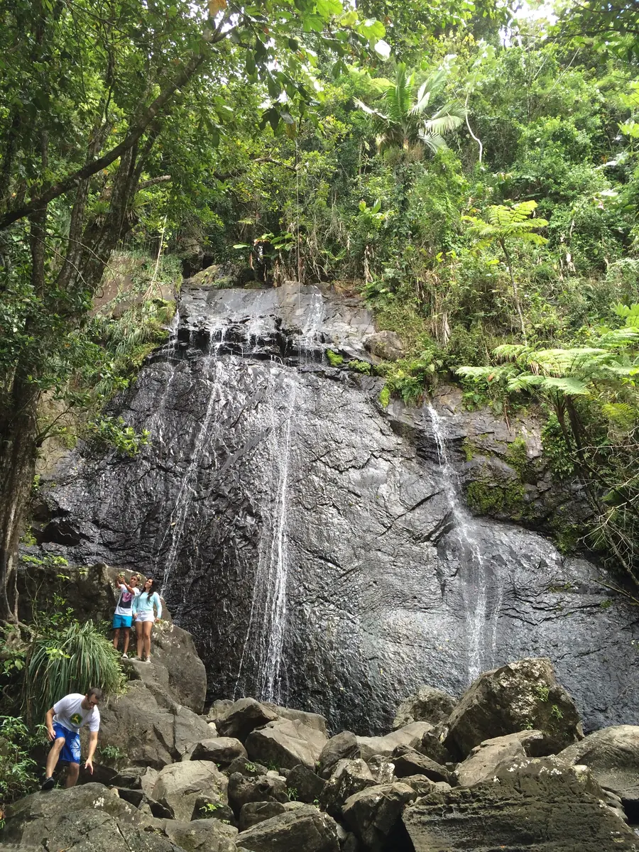
Waterfall descending a rock face in El Yunque rainforest

El Yunque

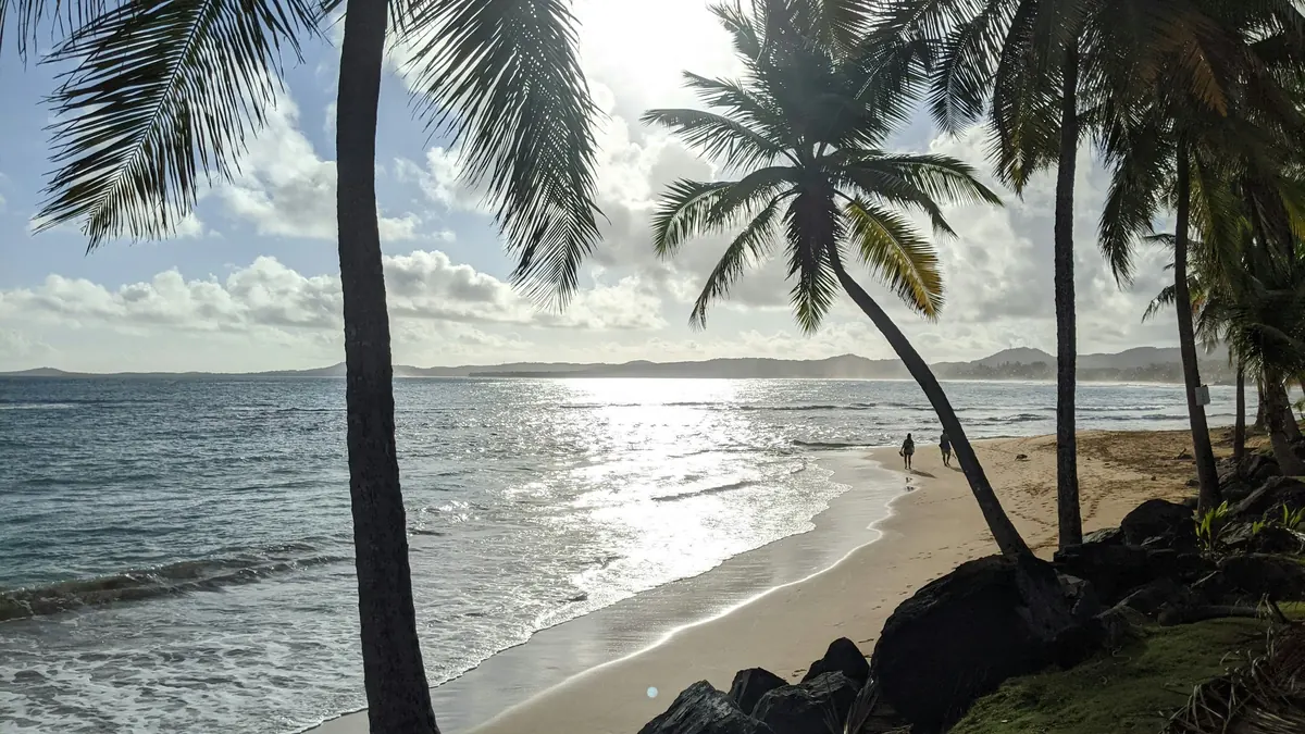
Personal trip photograph

Understand the geography

East Coast · forest, coast, offshore cays & Ceiba

Explore the map, then plan the stop

Choose a place on the map or from the cards below. Colors and icons distinguish beaches, food and other stops. This is an orientation map, not a driving route.

N ↑El Yunque · Nature · AreaEl Yunque · El Portal anchorLuquillo Beach · Beach · Specific destinationLuquillo BeachEat through the Luquillo kiosks · Food stop / area · AreaLuquillo kiosksFajardo · Town / practical stop · AreaFajardoSeven Seas Beach · Beach · Specific destinationSeven Seas BeachCayo Icacos · Beach · AreaCayo IcacosPalomino Island · Beach · AreaPalomino IslandCeiba ferry terminal · Transport · Specific destinationCeiba ferry terminalN ↑El Yunque · Nature · AreaLuquillo Beach · Beach · Specific destinationEat through the Luquillo kiosks · Food stop / area · AreaFajardo · Town / practical stop · AreaSeven Seas Beach · Beach · Specific destinationCayo Icacos · Beach · AreaPalomino Island · Beach · AreaCeiba ferry terminal · Transport · Specific destination
NatureBeachFood stop / areaTown / practical stopTransport

Lines connect labels to places, not routes. For arrival details and current access, use the guide entry. Location data © OpenStreetMap contributors (opens in a new tab).

Coast, forest or boat

Give one eastern experience the main slot

Luquillo is a useful coast-and-food chapter; Fajardo introduces boat outings, while Ceiba is the public island-ferry departure point.

A rainforest visit, beach time and an offshore trip are not interchangeable additions to the same afternoon. Choose the outing with the most fixed arrangements first, then let food or a nearby coast stop support it.

Compare lodging with your actual departure points. A region name is not a pickup address, and a map marker for Fajardo town is not a marina. If you are traveling from Metro, arrange both directions rather than assuming return transport will be simple.

town · Area

Luquillo

An eastern coastal stop that can bring a beach day and a food outing into the same itinerary.

Local discovery

This is an orientation anchor for the area, not a verified entrance or business. Choose an arrival point before traveling.

Plan this experience

Confirm the cost of the specific visit or activity, including the journey.

FajardoPhotography to come

town · Area

Fajardo

A coastal planning base for Seven Seas and nearby boat outings. Confirm the operator’s actual departure point; the town marker is not a marina or the public island ferry terminal.

Boat-trip baseCoastal planning

This is an orientation anchor for the area, not a verified entrance or business. Choose an arrival point before traveling.

Plan this experience

No total price is quoted. Check admission separately from transport, parking, food and any guided activity. A mapped shoreline or public area is not a verified free package.

The EBB approach

Plan by budget, then confirm the total

These are planning targets in USD, not verified package prices. Access, the journey, food and paid experiences belong in separate parts of the budget.

Free / Under $100 / Under $500 / Under $1,000 / $1,000+

Two related, separate stops

Luquillo: beach time and a food experience

The balneario and the kiosks can complement each other without being treated as one package.

Let the meal be part of the day rather than an afterthought between destinations. Choose a few things to taste after checking the individual kiosk’s operation and menu. This guide does not imply that every kiosk is open or that a specific dish is always available.

For the beach, confirm access arrangements, services and current conditions separately. A nearby restaurant strip does not establish lifeguard coverage, water suitability or free parking. Plan shade, supplies and your return based on your own visit.

Luquillo BeachPhotography to come

beach · Specific destination

Luquillo Beach

The balneario shoreline is a distinct stop from Luquillo town and the kiosks. Check current admission, facilities and conditions rather than treating all three as one all-inclusive outing.

Beach dayEastern base
Plan this experience

No total price is quoted. Check admission separately from transport, parking, food and any guided activity. A mapped shoreline or public area is not a verified free package.

Eat through the Luquillo kiosksPhotography to come

food · Area

Eat through the Luquillo kiosks

Choose a few things to taste rather than trying to visit every kiosk. Compare menus and leave time for the food to be part of the day.

Food discovery

Food-strip orientation anchor, not one selected restaurant. Confirm the individual business and arrival point.

Plan this experience

Compare the actual menu or operator quote. No price range has been verified for this experience.

Forest visit, not just a pin

El Yunque: choose a route from current information

The forest deserves a planned visit with an entrance, an open route and a return arrangement.

As reviewed October 2, 2026, USFS lists La Mina and Big Tree trail closures and a closed segment between the Los Picachos spur and El Yunque Peak. Do not follow an older waterfall-loop or summit itinerary without checking the current official alerts.

The Forest Service also warns that rideshare pickup is unavailable from the recreation corridor and El Portal. Arrange the return in advance. Confirm any admission, reservations and tour inclusions for the specific visit rather than assuming one forest-wide rule.

Keep the route realistic

Match the chosen route to the group, equipment and current conditions. This guide does not certify trail difficulty, safe water entry or availability from a scenic photograph.

Waterfall descending a rock face in El Yunque rainforest

El Yunque

nature · Area

El Yunque

A forest visit needs a chosen entrance and route, not just a pin. Current USFS alerts include trail closures; use the official route information before setting out.

Forest planningNature day

Directions use El Portal as a northern visitor-center anchor, not the forest summit or the entrance to every trail. Confirm your chosen route and current access with USFS.
Plan this experience

No total price is quoted. Check admission separately from transport, parking, food and any guided activity. A mapped shoreline or public area is not a verified free package.

Tall rainforest waterfall with visitors near its base in El Yunque

El Yunque

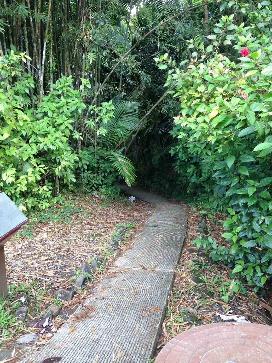
Wooden walkway through the dense rainforest in El Yunque

El Yunque

Different journeys

Seven Seas, Icacos & Palomino: mainland versus offshore

Seven Seas is a mainland beach; Icacos and Palomino require their own offshore access arrangements.

Choose Seven Seas if you want to research a mainland beach day. If the goal is an offshore cay, compare the actual operator’s dock, return time, inclusions and cancellation terms. An island pin cannot supply those answers.

Palomino’s resort and boat context means you must verify your particular access arrangement. Do not assume that a public ferry goes there or that an unrelated booking includes it. The island markers show geography; directions do not replace booking a boat.

Seven Seas BeachPhotography to come

beach · Specific destination

Seven Seas Beach

A Fajardo shoreline option that can anchor a mainland beach day. Check current services and conditions independently of an offshore excursion booking.

Mainland beach dayFajardo coast
Plan this experience

No total price is quoted. Check admission separately from transport, parking, food and any guided activity. A mapped shoreline or public area is not a verified free package.

beach · Area

Cayo Icacos

An offshore cay to approach as a boat outing rather than a drive-to beach. Confirm the operator, departure dock, return arrangements and inclusions before committing.

Boat outingOffshore scenery

Offshore island location only. Directions do not book transport or identify a departure dock; arrange access and the meeting point with your operator.

Plan this experience

No total price is quoted. Check admission separately from transport, parking, food and any guided activity. A mapped shoreline or public area is not a verified free package.

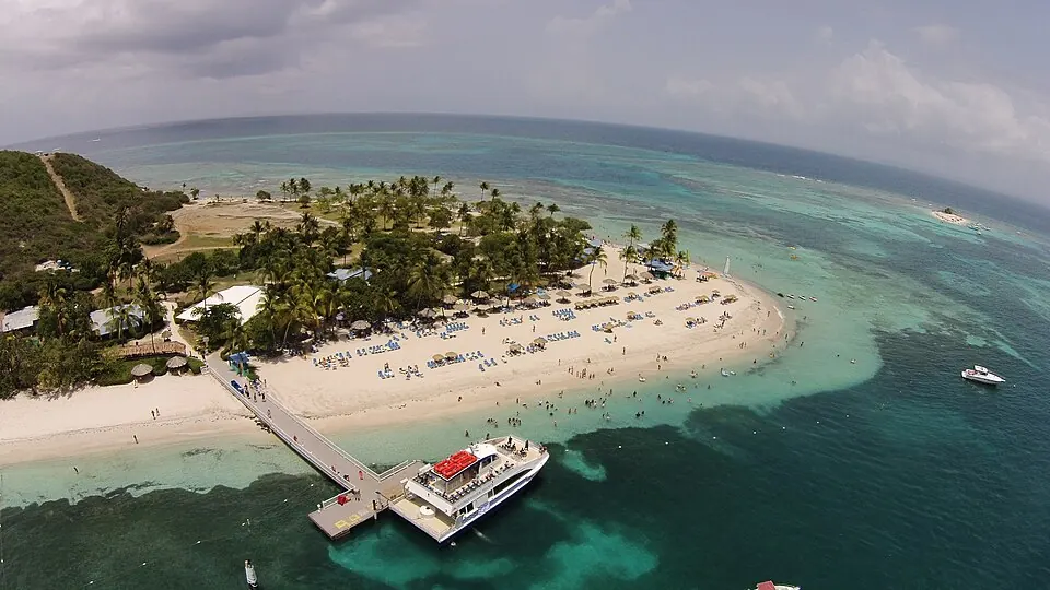
Palomino Island — Aerial view of Palomino Island

Palomino Island

Photo courtesy of Kyle Hawton (opens in a new tab) · CC BY-SA 4.0 (opens in a new tab) · Resized/converted; display may crop.

beach · Area

Palomino Island

An offshore island associated with resort and boat experiences. Do not assume public ferry service or that access is included with another booking; confirm the specific arrangement.

Access researchOffshore planning

Offshore island location only. Directions do not book transport or identify a departure dock; arrange access and the meeting point with your operator.

Plan this experience

No total price is quoted. Check admission separately from transport, parking, food and any guided activity. A mapped shoreline or public area is not a verified free package.

Transport chapter

Ceiba connects you to Vieques & Culebra

The current public routes depart from Ceiba, not the old Fajardo ferry location.

Use the official ferry route for the island you intend to visit and confirm outward and return tickets. The operator currently publishes separate Ceiba–Vieques and Ceiba–Culebra schedules; this guide deliberately does not hard-code fares or departure times.

Reaching the terminal is only the mainland part of the journey. Arrange onward transport on the island, understand the boarding requirements and leave room for disruption. If your main goal is an evening experience on Vieques, compare an overnight plan instead of squeezing it between daytime ferries.

Ceiba ferry terminalPhotography to come

town · Specific destination

Ceiba ferry terminal

The mainland public-ferry departure point for Vieques and Culebra at Roosevelt Roads. Choose the correct island route and confirm both outward and return tickets.

Island connectionTransport planning

Terminal-area anchor at Roosevelt Roads. Follow the operator’s current boarding and parking instructions, not a route to an old Fajardo terminal.

Plan this experience

No total price is quoted. Check admission separately from transport, parking, food and any guided activity. A mapped shoreline or public area is not a verified free package.

Eastern planning & costs

Spend on the experience that matters most

A food-led beach day, guided forest outing and boat excursion have different budgets and constraints.

Beach & food day

Keep the shoreline and kiosks as separate stops; check admission, parking, food and equipment rather than quoting an unverified total.

Forest day

Choose an open route first. If using a tour, check whether transport, admission and equipment are included.

Boat or ferry day

Compare the full chain: mainland transport, tickets or charter, island transport, supplies and a confirmed return.

Questions before you go

Can I take the public ferry from Fajardo?

The current operator publishes mainland routes from Ceiba to Vieques and Culebra. Use the actual terminal and route information rather than older Fajardo instructions.

Can I plan the classic La Mina waterfall route?

USFS currently lists La Mina and Big Tree closures. Check current alerts and choose an open route; do not rely on an older itinerary.

Are Icacos and Palomino drive-to beaches?

No. They are offshore islands with separate boat or resort access arrangements. Confirm your operator and departure point; map directions are geographic orientation only.