Explore by Budget · Puerto Rico guides

North Coast Puerto Rico: Beaches, Karst Country & Coastal Stops

Follow the coast beyond Metro for a different island landscape: sculpted shorelines, limestone country and towns worth more than a quick stop. Choose a coastal chapter, then leave room to enjoy it.

Find your bearings
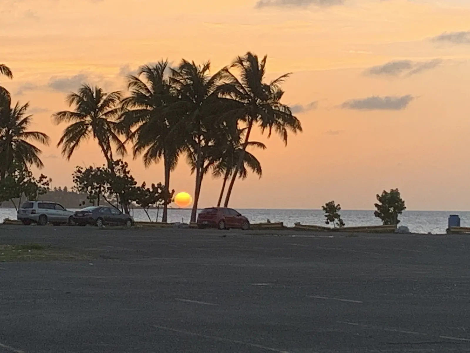
Palm trees and the Dorado coast at sunset

Dorado · North Coast

Personal trip photograph

Understand the geography

North Coast · Dorado to the Guajataca coast

Explore the map, then plan the stop

Choose a place on the map or from the cards below. Colors and icons distinguish beaches, food and other stops. This is an orientation map, not a driving route.

N ↑Dorado · Town / practical stop · AreaDoradoMar Chiquita · Beach · Specific destinationMar ChiquitaPlaya Los Tubos · Beach · Specific destinationPlaya Los TubosArecibo · History & culture · AreaAreciboMirador de Guajataca · Scenic stop · Specific destinationMirador de GuajatacaN ↑Dorado · Town / practical stop · AreaMar Chiquita · Beach · Specific destinationPlaya Los Tubos · Beach · Specific destinationArecibo · History & culture · AreaMirador de Guajataca · Scenic stop · Specific destination
Town / practical stopBeachHistory & cultureScenic stop

Town / practical stop · Area

Dorado

An eastern starting point for the north coast. Compare lodging here with your planned Manatí and Arecibo outings; a resort address does not establish public beach access.

Explore this stop with EBB →

This is an orientation anchor for the area, not a verified entrance or business. Choose an arrival point before traveling.
Lines connect labels to places, not routes. For arrival details and current access, use the guide entry. Location data © OpenStreetMap contributors (opens in a new tab).

Find your bearings

Choose a stretch of coast, not the whole north

Dorado is nearer the Metro side; Manatí and Arecibo continue west, with Guajataca providing a natural transition toward Isabela.

Use your base to make the route smaller. A Manatí beach day and an Arecibo town day are useful separate plans, while a lookout can complement a journey you already need to make. Adding every named stop can leave the coast feeling like a checklist viewed through a windshield.

The northern karst landscape helps explain why caves and unusual coastal formations appear together in this region. Geography is durable; whether a particular cave attraction is accepting visitors is a separate, date-sensitive question.

From a Metro base

Choose a northern cluster for the day and confirm the return arrangement. A short list near one town is easier to adapt than an island-length circuit.

Staying in the north

Compare the lodging location with your actual beach and town choices. A beachfront resort name does not confirm public access to every adjacent shoreline.

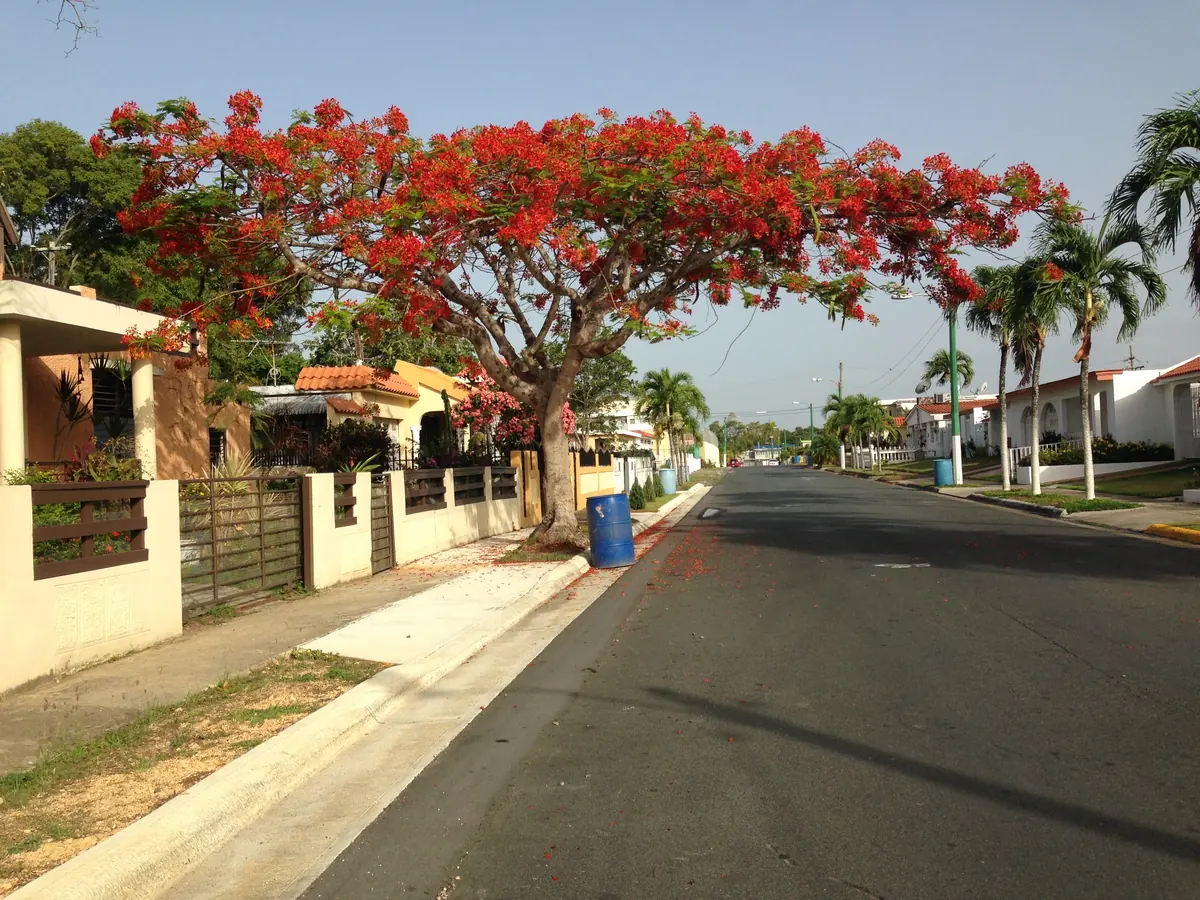
Red flowering tree beside a street in Dorado

Dorado

town · Area

Dorado

An eastern starting point for the north coast. Compare lodging here with your planned Manatí and Arecibo outings; a resort address does not establish public beach access.

North-coast baseTown & coast

This is an orientation anchor for the area, not a verified entrance or business. Choose an arrival point before traveling.
Plan this experience

No total price is quoted. Check admission separately from transport, parking, food and any guided activity. A mapped shoreline or public area is not a verified free package.

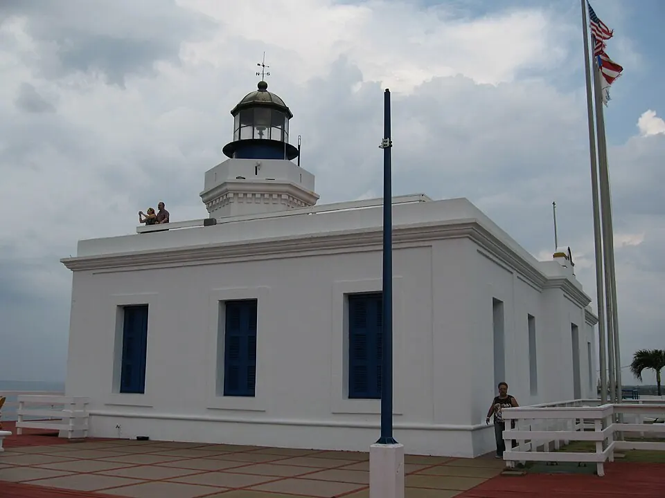
Arecibo Lighthouse — Punta Los Morrillos Lighthouse, Arecibo, Puerto Rico

Arecibo Lighthouse

Photo courtesy of Darwininan (talk) (opens in a new tab) · CC BY-SA 3.0 (opens in a new tab) · Resized/converted; display may crop.

town · Area

Arecibo

A north-coast town beside karst country. Give its town and coast their own time instead of using it only as a stop on the way to a cave attraction.

Town discoveryNorthern landscape

This is an orientation anchor for the area, not a verified entrance or business. Choose an arrival point before traveling.
Plan this experience

No total price is quoted. Check admission separately from transport, parking, food and any guided activity. A mapped shoreline or public area is not a verified free package.

Choose the shoreline

Mar Chiquita & Los Tubos: two different coastal stops

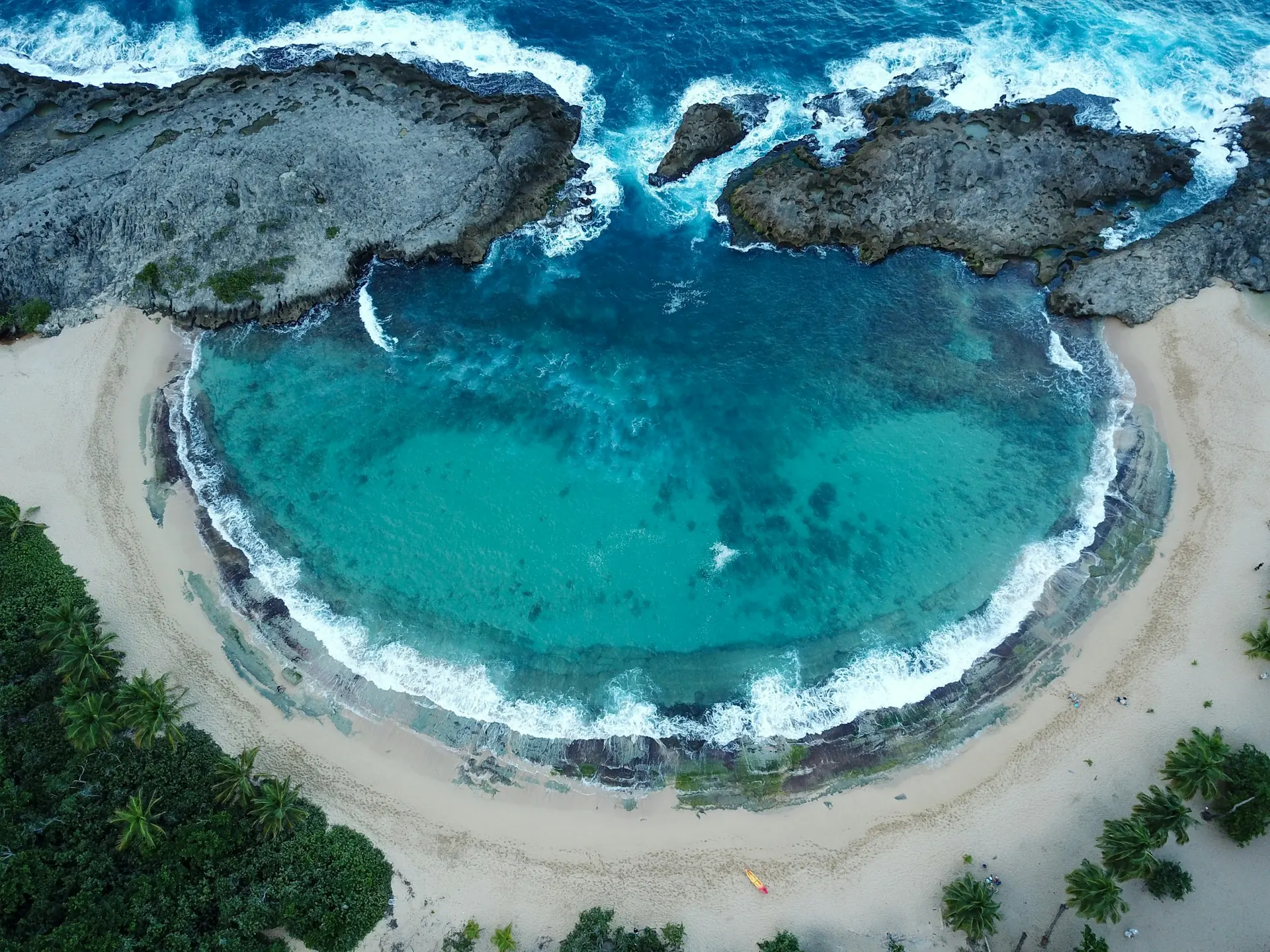
Mar Chiquita remains a selective firsthand Editor’s Pick. Los Tubos is a researched alternative nearby, not a second claimed firsthand experience.

Choose the main beach first, then decide whether a second shoreline genuinely improves your day. Mar Chiquita’s distinctive setting can be the visual centerpiece; Los Tubos offers another perspective on Manatí’s coast. You do not need to spend equal time at both.

A sheltered-looking photograph cannot establish safe water conditions. Keep scenery, beach access and water activities as separate decisions, and confirm facilities and parking for your visit instead of assuming that a familiar beach name includes them.

Budget the day, not just admission

Include the journey, parking where applicable, food, shade and equipment. This guide does not assign an unverified total to either beach.

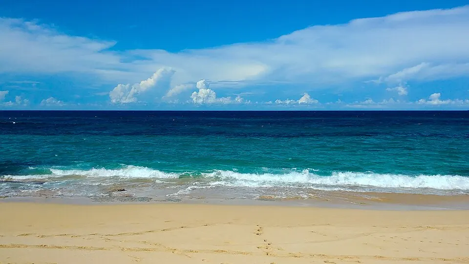
Playa Los Tubos · Manatí — Playa Los Tubos, Manatí, Puerto Rico (2019)

Playa Los Tubos · Manatí

Photo courtesy of Yarfpr (opens in a new tab) · CC BY-SA 4.0 (opens in a new tab) · Resized/converted; display may crop.

beach · Specific destination

Playa Los Tubos

A second Manatí shoreline to consider alongside Mar Chiquita. Treat the surf-facing coast as a place to assess on arrival, not a promise of swimming conditions.

Surf culture · check conditionsCoastal sceneryManatí beach day

Feature location, not a verified entrance. Confirm the approach and current access before traveling.

Plan this experience

No total price is quoted. Check admission separately from transport, parking, food and any guided activity. A mapped shoreline or public area is not a verified free package.

The EBB approach

Plan by budget, then confirm the total

These are planning targets in USD, not verified package prices. Access, the journey, food and paid experiences belong in separate parts of the budget.

Free / Under $100 / Under $500 / Under $1,000 / $1,000+

Town & landscape

Give Arecibo its own chapter

Town exploration and the surrounding karst country offer a different rhythm from a beach-only route.

Arecibo can be a useful point to pause for town discovery and an independently chosen meal. Build that visit around a manageable area rather than treating the municipality as one exact attraction. The map’s area anchor is a starting point for orientation, not a verified restaurant entrance.

The observatory is an important part of Arecibo’s scientific story, but that history is not evidence of current visitor access. Arecibo C3 now publishes visitor-program information, but current fall tickets and access were not confirmed for this build. Check its current ticket calendar and site limitations before planning a visit; neither an old closure notice nor an old tour listing establishes today’s availability.

Coast-to-coast transition

Guajataca: a scenic pause toward the west

The Mirador de Guajataca is an ocean lookout in Quebradillas. It is distinct from the inland lake and from the nearby tunnel.

This stop makes most sense when it fits your direction of travel toward Isabela or the west coast. Use it to break up the journey and see the coastline, rather than building a hurried detour solely to collect another pin.

Confirm a lawful place to stop and current access on arrival. Do not assume vendors are present, or extend the plan into a tunnel or trail simply because it appears close on the map. Those would require their own route and condition checks.

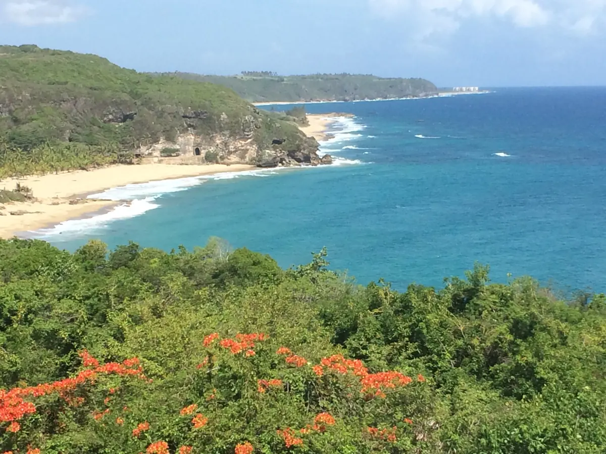
Guajataca coastline and blue bay framed by red flowers

Guajataca · North Coast

nature · Specific destination

Mirador de Guajataca

A coastal lookout in Quebradillas, useful when continuing toward Isabela. This is the ocean viewpoint, not the inland Guajataca reservoir.

Scenic stopNorth-to-west transition

Feature location, not a verified entrance. Confirm the approach and current access before traveling.

Plan this experience

No total price is quoted. Check admission separately from transport, parking, food and any guided activity. A mapped shoreline or public area is not a verified free package.

A guided northern adventure

Cueva Ventana: a window into karst country

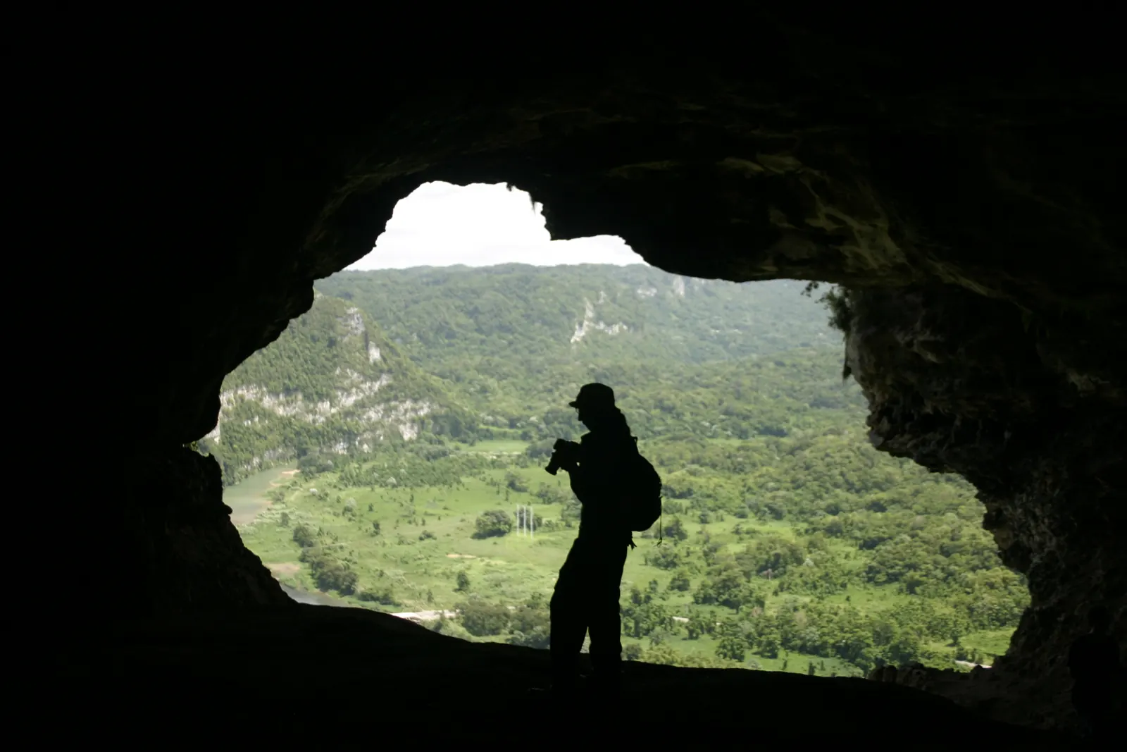
A cave opening frames the Río Grande de Arecibo valley—the view is the payoff, while the cave itself is part of the journey.

The official operator currently offers guided tours and a reservation path. Check your date, the current quote and participation requirements directly; this is not unrestricted cave access. Wear and bring what the operator specifies, and confirm the meeting point rather than following a valley-view pin.

Keep this separate from Río Camuy Cave Park. One attraction’s tour availability does not establish that another cave system is open.

Cueva Ventana · Arecibo — Cueva Ventana in Puerto Rico

Cueva Ventana · Arecibo

Photo courtesy of J & E (opens in a new tab) · CC BY 2.0 (opens in a new tab) · Resized/converted; display may crop.

nature · Specific destination

Cueva Ventana

A limestone cave with a natural window over the Río Grande de Arecibo valley. Make this a guided cave visit, with the operator’s current reservations and participation requirements confirmed before traveling.

Guided cave visitKarst scenery
Plan this experience

No total price is quoted. Check admission separately from transport, parking, food and any guided activity. A mapped shoreline or public area is not a verified free package.

Current planning constraint

Camuy caves: keep the interest, check the access

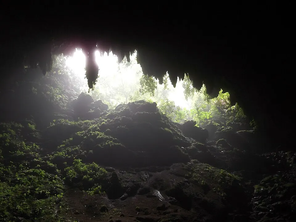
Reviewed October 2, 2026: Discover Puerto Rico’s cave article lists Río Camuy Cave Park as closed until further notice.

Do not make the cave park the fixed centerpiece of a booked northern itinerary based on an older tour page. The landscape remains worth understanding, but this guide is not presenting the closed attraction as an available excursion.

If the park reopens, check the actual operator’s reservation process, route, admission and participation requirements before adding it. Another cave or river tour is not automatically an equivalent substitute; its access and activity demands need independent verification.

Río Camuy Cave Park · historic scenery, access notice applies — Rio Camuy Cave Park

Río Camuy Cave Park · historic scenery, access notice applies

Photo courtesy of Jay Sturner from USA (opens in a new tab) · CC BY 2.0 (opens in a new tab) · Resized/converted; display may crop.

Journey, costs & flexibility

A workable north-coast plan

A focused beach day, a town day or a coastal transfer with one scenic stop can each be a complete experience.

One day

Choose Manatí beaches or Arecibo town as the anchor. Keep a flexible meal and leave time for the return rather than assuming a cave visit can be added.

Continuing west

Consider Guajataca along the route, then give Isabela or Aguadilla a separate chapter in the West Coast guide.

Before booking

Confirm transport, parking, access and any paid activity independently. No current hours, safety classification or all-in price are inferred from the map.

Questions before you go

Is the north coast just a day trip from San Juan?

It can be a focused outing, but where you stay should follow your priorities. Multiple beach and town days may justify a northern base; compare the actual journeys rather than assuming one base suits every stop.

Can I currently visit Camuy River Cave Park?

The official tourism article reviewed October 2, 2026 lists it as closed until further notice. Recheck for a new official reopening announcement before arranging a visit.

Are Mar Chiquita and Los Tubos verified free experiences?

Their identities and locations are verified, but the total visit cost is not. Check access, parking, transport and any equipment separately; a public shoreline does not make the whole outing free.