Explore by Budget · Puerto Rico guides

Central Mountains Puerto Rico: Adventure, Food & Scenic Routes

Make the journey part of the experience. Choose a mountain adventure, a food area or a scenic route segment, and leave room for town stops without turning the day into a race.

Find your bearings
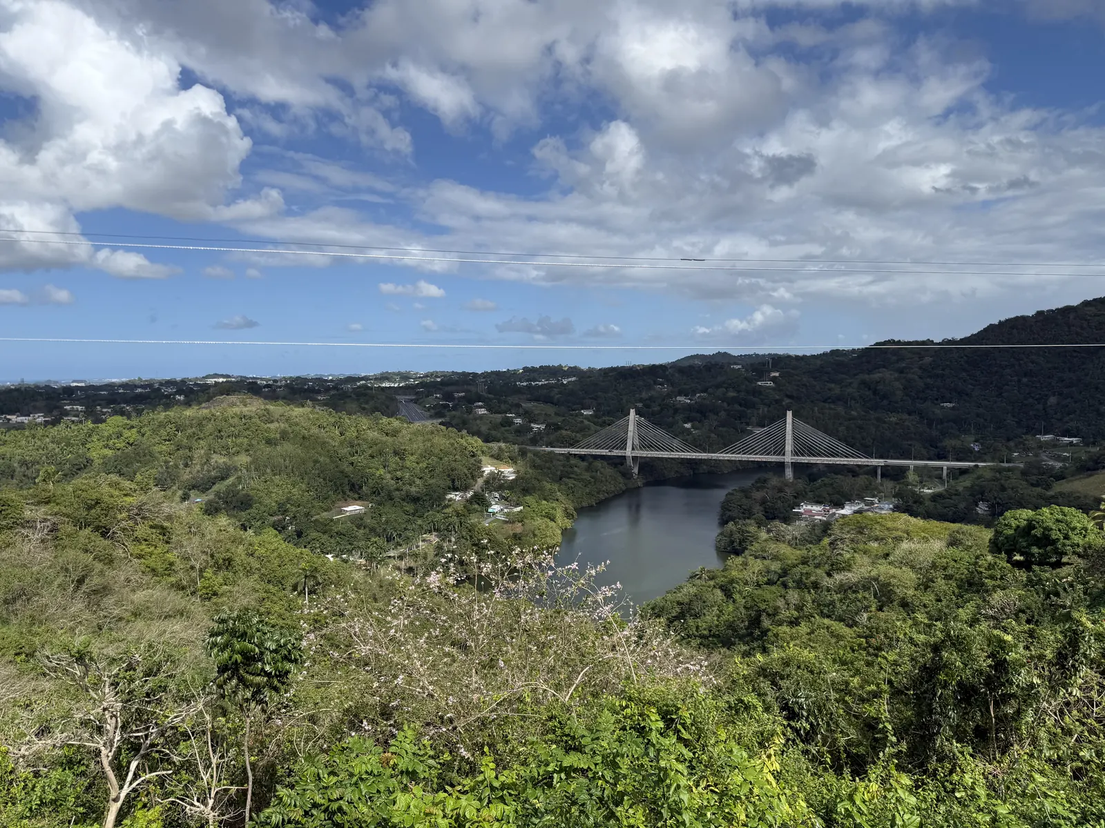
Cable-stayed bridge and green hills viewed from Naranjito

Naranjito · Central Mountains

Personal trip photograph

Understand the geography

Central Mountains · orientation within Puerto Rico

Explore the map, then plan the stop

Choose a place on the map or from the cards below. Colors and icons distinguish beaches, food and other stops. This is an orientation map, not a driving route.

N ↑Adjuntas · Town / practical stop · AreaAdjuntasOrocovis · Town / practical stop · AreaOrocovisToro Verde · Nature · Specific destinationToro VerdeChorro de Doña Juana · Scenic stop · Specific destinationChorro de Doña JuanaGuavate / Cayey · Food stop / area · AreaGuavate / CayeyN ↑Adjuntas · Town / practical stop · AreaOrocovis · Town / practical stop · AreaToro Verde · Nature · Specific destinationChorro de Doña Juana · Scenic stop · Specific destinationGuavate / Cayey · Food stop / area · Area
Town / practical stopNatureScenic stopFood stop / area

Town / practical stop · Area

Adjuntas

A western mountain town to consider when shaping a longer inland trip. Give town time and any separately arranged coffee or nature visit their own space in the itinerary.

Explore this stop with EBB →

This is an orientation anchor for the area, not a verified entrance or business. Choose an arrival point before traveling.
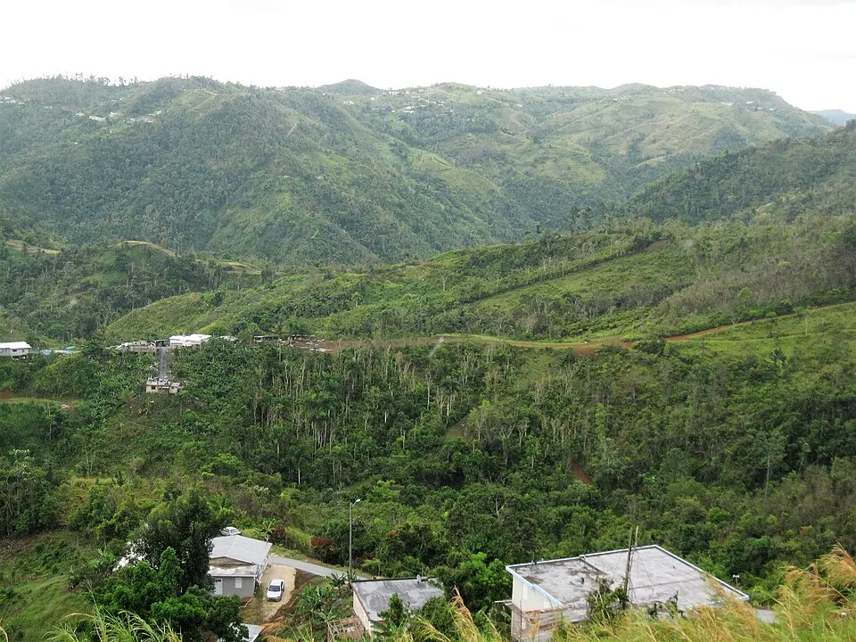
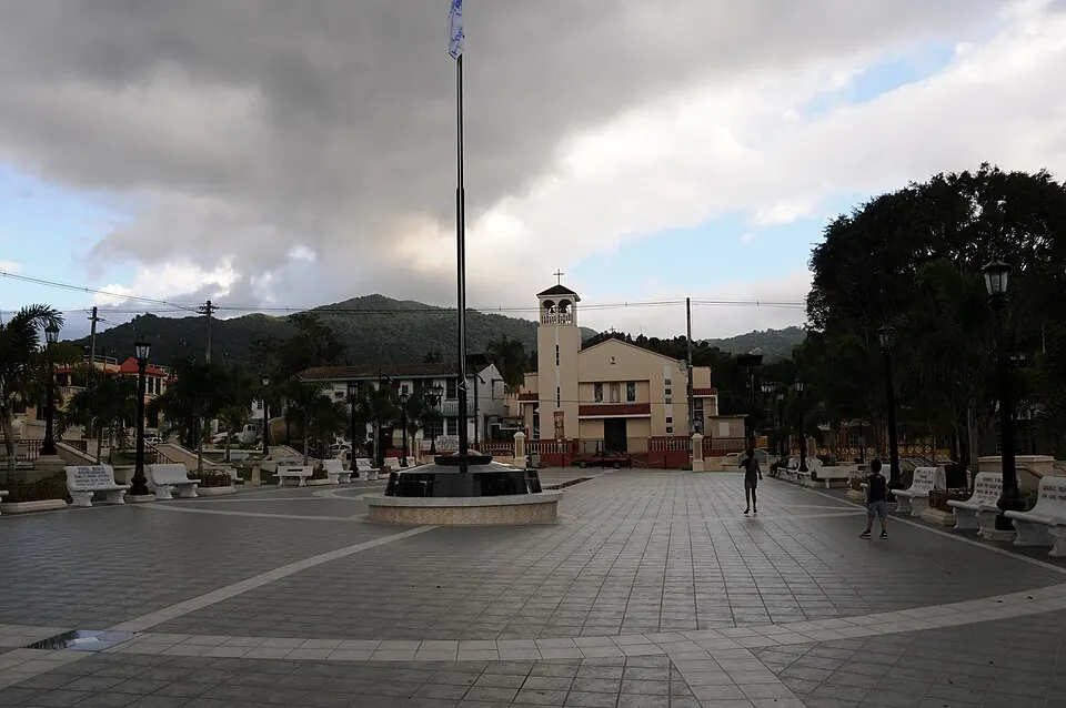
Lines connect labels to places, not routes. For arrival details and current access, use the guide entry.

Different bases, different days

Choose a mountain chapter

Orocovis, Adjuntas and the Guavate area in Cayey are distinct starting points. They should not be treated as one compact destination.

Start with the experience that matters most, then build a route around it. Orocovis can anchor an adventure day; a western mountain base such as Adjuntas can support a different inland chapter. The best base follows the journey you actually intend to make.

Allow room for the drive rather than applying coastal travel assumptions to winding inland roads. Check current routes and conditions for your dates and avoid planning an unfamiliar mountain return entirely after dark. This guide does not promise a fixed driving time.

Cordillera Central seen from Orocovis — La Cordillera Central desde el mirador en Orocovis, Puerto Rico

Cordillera Central seen from Orocovis

Photo courtesy of The Eloquent Peasant (opens in a new tab) · CC BY-SA 4.0 (opens in a new tab) · Resized/converted; display may crop.

town · Area

Orocovis

A mountain base for a focused day around Toro Verde or a scenic outing. Town, adventure park and waterfall are different stops; choose a route rather than chasing all three.

Mountain dayAdventure base

This is an orientation anchor for the area, not a verified entrance or business. Choose an arrival point before traveling.
Plan this experience

No total price is quoted. Check admission separately from transport, parking, food and any guided activity. A mapped shoreline or public area is not a verified free package.

town · Area

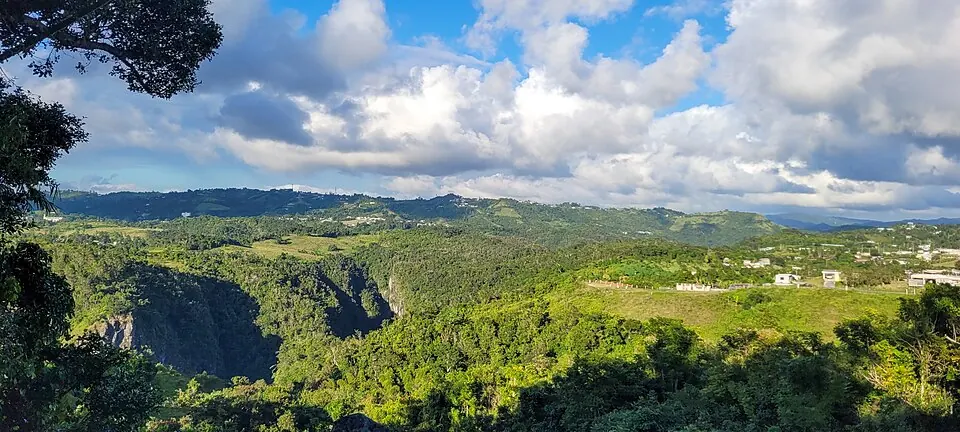
Adjuntas

A western mountain town to consider when shaping a longer inland trip. Give town time and any separately arranged coffee or nature visit their own space in the itinerary.

Mountain baseTown discovery

This is an orientation anchor for the area, not a verified entrance or business. Choose an arrival point before traveling.
Plan this experience

No total price is quoted. Check admission separately from transport, parking, food and any guided activity. A mapped shoreline or public area is not a verified free package.

The EBB approach

Plan by budget, then confirm the total

These are planning targets in USD, not verified package prices. Access, the journey, food and paid experiences belong in separate parts of the budget.

Free / Under $100 / Under $500 / Under $1,000 / $1,000+

A paid centerpiece

Toro Verde: make room for a mountain-sized adventure

The place is an existing firsthand candidate, while the activity-planning record remains researched. It is not automatically an Editor’s Pick.

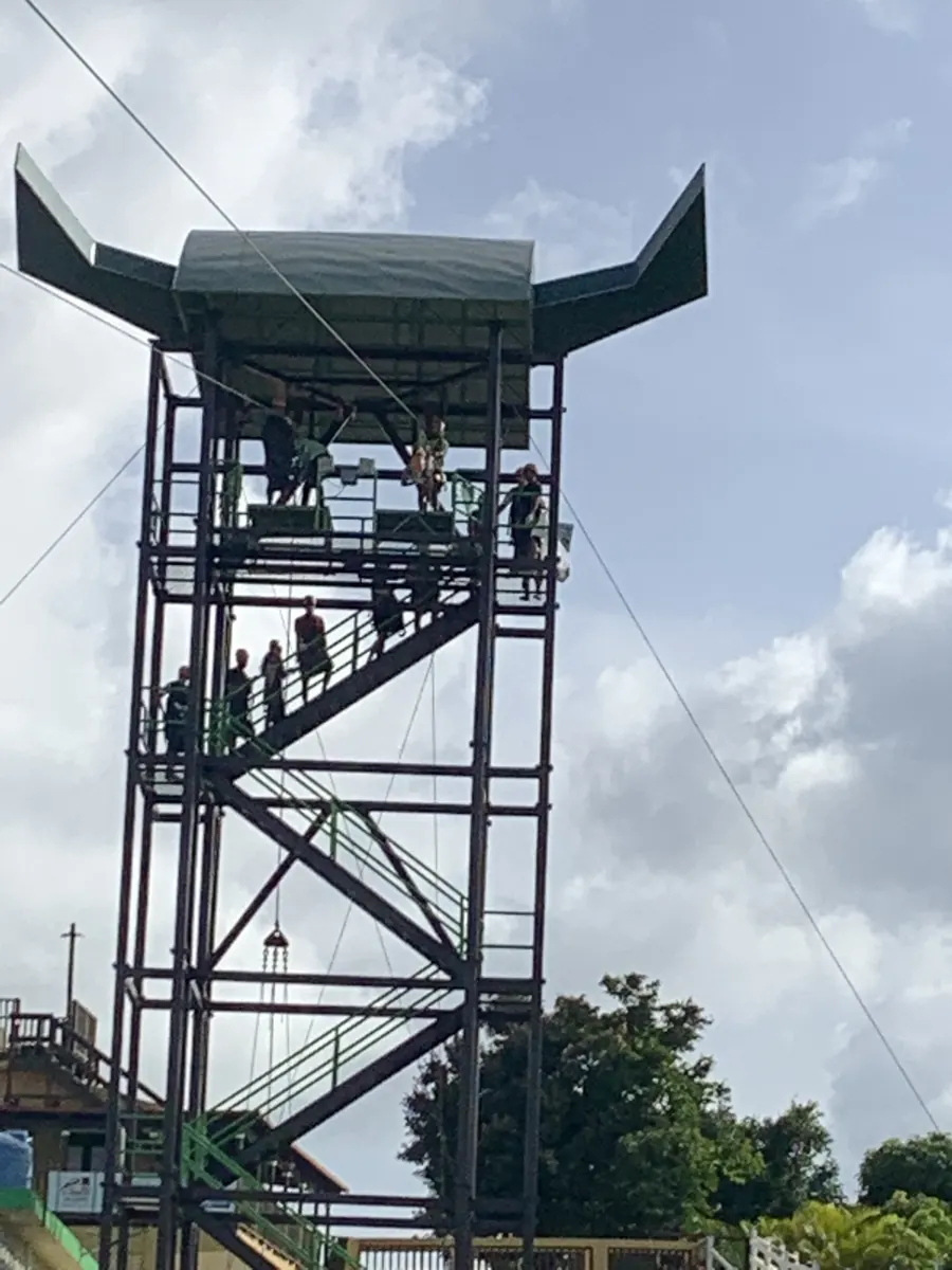
El Monstruo is the park’s signature horizontal-flight zip line, with mountain scenery turning the ride into the day’s centerpiece. The operator describes a roughly 2.5-kilometer cable. Compare the actual activity, participation restrictions and inclusions instead of assuming every attraction is bundled into one ticket. Requirements differ by experience, so check the exact package that interests your group.

Give the visit its own main slot. Confirm arrival arrangements, footwear and equipment requirements, weather terms and the return before adding more stops. This guide deliberately avoids hard-coding promotional prices or universal height and weight rules.

Tall zipline tower at Toro Verde above the mountain landscape

Toro Verde · Orocovis

adventure · Specific destination

Toro Verde

Make mountain scenery part of the thrill at Toro Verde in Orocovis. El Monstruo’s horizontal-flight zip line can anchor an adventure day; compare the exact package, participation requirements and weather terms with the official operator before booking.

Adventure
Plan this experience

Confirm the cost of the specific visit or activity, including the journey.

Nature with a guide

Cañón de San Cristóbal: a different mountain adventure

Between Barranquitas and Aibonito, the canyon offers dramatic walls and river scenery. Give it a deliberately planned day rather than squeezing it between distant stops.

Para la Naturaleza publishes a guided canyon-trip description, with sturdy footwear and physical preparation among the planning considerations. The page showed no available departures when checked October 8, 2026. Contact the conservation provider for current dates, the route, a quote and eligibility before building the trip around it.

A current bookable price could not be confirmed, so check the quote directly instead of relying on an older displayed rate. Routes can involve rough ground, steep approaches and river conditions; follow the provider’s requirements and do not assume independent entry is permitted.

Cañón de San Cristóbal · Barranquitas / Aibonito — Cañón de San Cristóbal, Aibonito-Barranquitas, Puerto Rico (2022)

Cañón de San Cristóbal · Barranquitas / Aibonito

Photo courtesy of Yarfpr (opens in a new tab) · CC BY-SA 4.0 (opens in a new tab) · Resized/converted; display may crop.

adventure · Area

Cañón de San Cristóbal

A deep canyon between Barranquitas and Aibonito, with river scenery and a very different mountain-adventure rhythm. Research a guided visit with Para la Naturaleza; uneven terrain and strenuous routes make this a planned outing rather than an improvised roadside hike.

Guided nature adventureMountain landscape

The marker is an orientation anchor for this area, not its only destination. Choose your entrance or arrival point before traveling.

Plan this experience

No total price is quoted. Check admission separately from transport, parking, food and any guided activity. A mapped shoreline or public area is not a verified free package.

Chinchorreo with a plan

Mountain food: fewer stops, more time at each

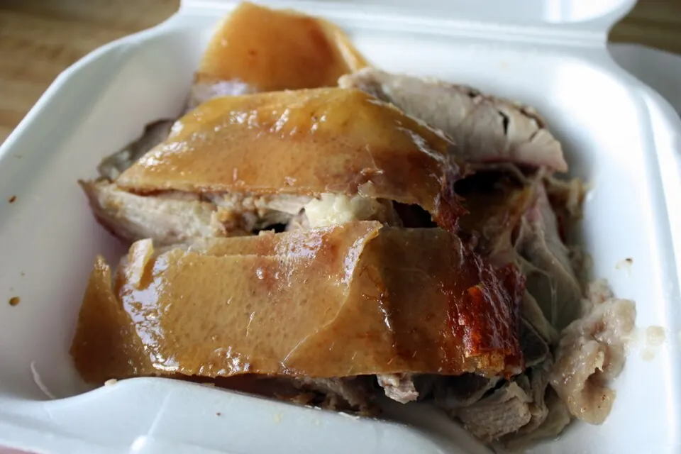
Guavate is a food area in Cayey, not one restaurant. First choose the area, then verify the businesses you want to visit.

Use the lechón-route identity as a starting point for a meal-led outing. Check individual operation and menus rather than publishing a universal opening day or claiming that every venue serves the same experience.

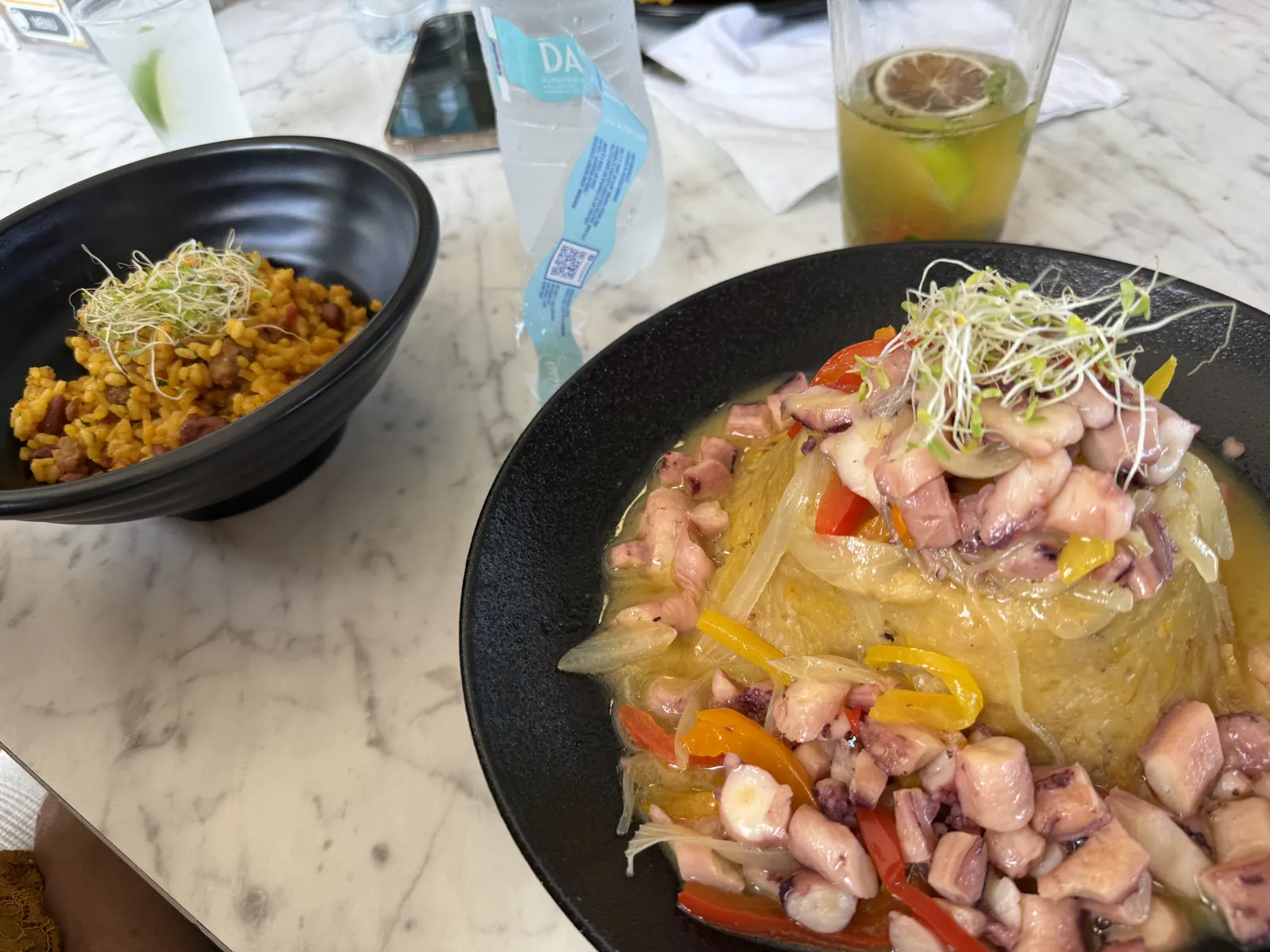
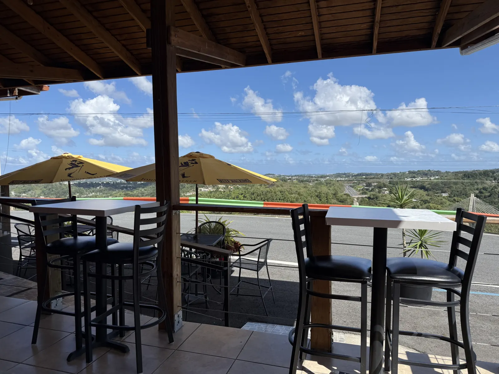
Keep the route manageable and arrange a driver. A memorable food day can be one main meal with another considered stop, rather than a long circuit made to look impressive on a map. The personal photographs below record mountain-view dining in Naranjito, a separate municipality from Guavate in Cayey. The terrace is identified as Deleite en la Montaña; confirm current operation directly before planning a visit.

Lechón in Guavate · Cayey — Get the full scoop

Lechón in Guavate · Cayey

Photo courtesy of Krista (opens in a new tab) · CC BY 2.0 (opens in a new tab) · Resized/converted; display may crop.

food · Area

Guavate / Cayey

A mountain food area associated with the lechón route. Choose a specific business before traveling; this area marker is not an endorsement of every restaurant or a verified opening time.

Food-led dayMountain discovery

This is an orientation anchor for the area, not a verified entrance or business. Choose an arrival point before traveling.
Plan this experience

No total price is quoted. Check admission separately from transport, parking, food and any guided activity. A mapped shoreline or public area is not a verified free package.

Personal photograph of Deleite en la Montaña’s covered dining terrace overlooking Naranjito hills

Deleite en la Montaña — mountain-view dining in Naranjito.

Personal photograph of mofongo con pulpo and a side dish during a Naranjito meal

Mofongo with octopus (mofongo con pulpo) — Naranjito, Puerto Rico.

The drive as an experience

Ruta Panorámica: plan a mountain day

The ACT describes a 266-kilometer (approximately 165-mile) corridor across the Cordillera Central. For a day trip, consider choosing a section rather than trying to cover the entire route.

Choose a chapter near your base and identify the actual roads and lawful stopping places before traveling. The official ACT corridor overview supplies geographic context, but it does not certify present-day road conditions or every roadside business.

Use the Adjuntas area as orientation for a western mountain chapter, not as the exact start of the whole route. Leave room for daylight, weather and a return alternative with the length of your chosen section in mind.

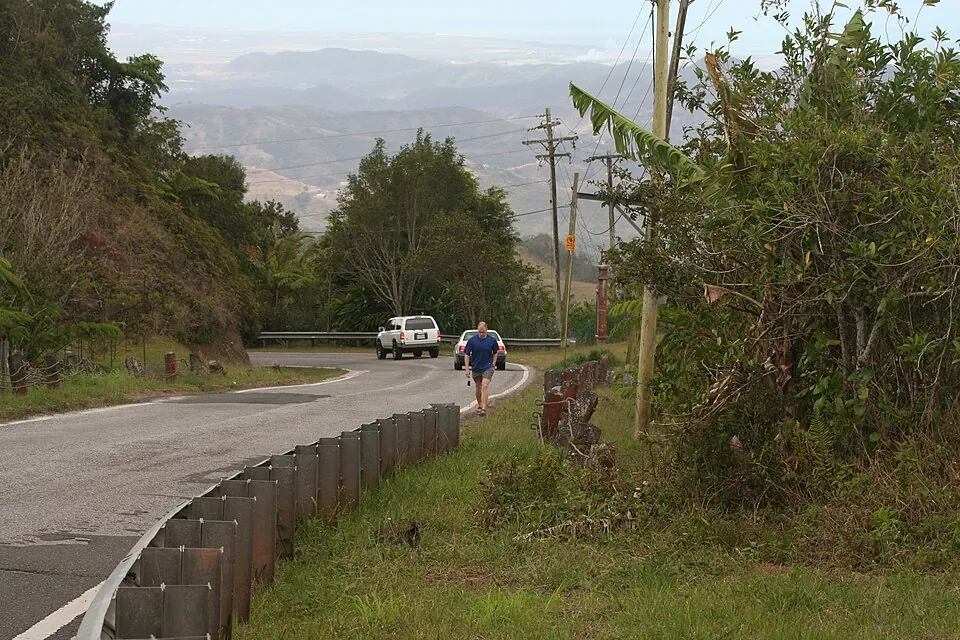
Ruta Panorámica · Collores, Juana Díaz — We took La Ruta Panorámica across the middle of PR to get to El Toro Negro

Ruta Panorámica · Collores, Juana Díaz

Photo courtesy of Steven Isaacson (opens in a new tab) · CC BY-SA 2.0 (opens in a new tab) · Resized/converted; display may crop.

nature · Area

Choose a chapter of Ruta Panorámica

The mountain route is a corridor, not one attraction. For a day trip, consider a section near your base. Check roads for your dates and leave space for daylight stops.

Scenic driveMountain geography

This is an orientation anchor for the area, not a verified entrance or business. Choose an arrival point before traveling.
Plan this experience

No total price is quoted. Check admission separately from transport, parking, food and any guided activity. A mapped shoreline or public area is not a verified free package.

A considered waterfall stop

Chorro de Doña Juana: a scenic mountain waterfall

The waterfall by PR-149 can complement a mountain route when current access makes sense.

Seeing a waterfall and entering its water are different choices. This guide identifies the scenic feature without guaranteeing safe swimming, climbing or a suitable roadside parking place.

Check the approach and conditions before adding it, and be willing to leave it out if there is no lawful, workable stop. Avoid making a detour compete with a timed adventure booking or a long return drive.

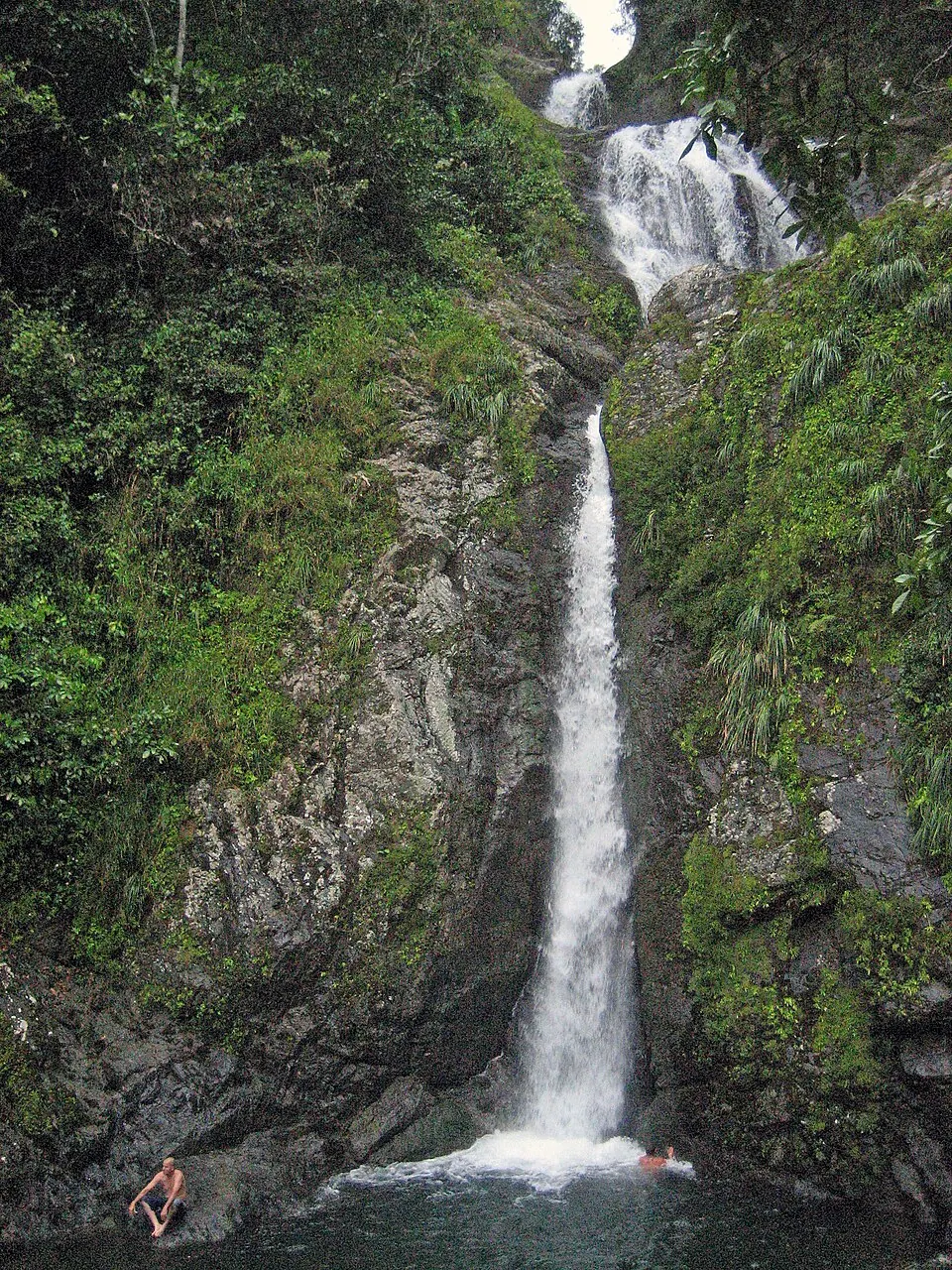
Chorro de Doña Juana · Orocovis — Salto Doña Juana, Orocovis, Puerto Rico / Waterfall and swimming hole

Chorro de Doña Juana · Orocovis

Photo courtesy of Jose Oquendo from Freeport, NY (opens in a new tab) · CC BY 2.0 (opens in a new tab) · Resized/converted; display may crop.

nature · Specific destination

Chorro de Doña Juana

A waterfall beside PR-149 to consider as a scenic stop. A geographic point does not verify parking, foot access or safe water entry; assess access and current conditions separately.

Waterfall sceneryMountain route
Plan this experience

No total price is quoted. Check admission separately from transport, parking, food and any guided activity. A mapped shoreline or public area is not a verified free package.

Transport, food & paid adventure

Build one complete inland day

The mountain journey belongs in the budget and itinerary, even when the scenery itself does not involve a ticket.

Adventure-led

Reserve the chosen Toro Verde activity after checking participation and package terms. Keep the rest of the route flexible.

Food-led

Pick a food area and confirm a small number of businesses. Plan the driver and return before adding distant mountain stops.

Scenery-led

Choose a manageable route segment with confirmed road access. Do not assume a corridor plan verifies current closures, parking or trail availability.

Questions before you go

Do the Naranjito photographs recommend a currently operating restaurant?

The terrace photo records the supplied firsthand visit to Deleite en la Montaña. The food photo remains attributed to Naranjito generally. The guide does not publish current hours, a menu or confirmed operating availability; contact the business directly before planning a visit.

Does this map show the full Ruta Panorámica?

No. It orients you to mountain places used in this guide. Select a real route segment using current road information; the corridor is not reduced to one destination pin.

Are all Toro Verde experiences included in one ticket?

Do not assume so. Compare the actual operator package, restrictions and inclusions for your chosen experience before booking.